2024 Alaska Road Trip (Week 2)
This journal posting chronicles Week 2 (Sunday June 30th - Saturday July 6th) of a road trip to Alaska and back with Diane, Kenny and Deneen.
Index for Week 2
Day 8: Sunday June 30th - Mile 0 Park & Campground, Dawson Creek, BC
Day 9: Monday July 1st - Prophet Airstrip Dispersed Camping, Prophet River, BC
Day 10: Tuesday July 2nd - Summit Lake Campground, Stone Mountain Provincial Park, BC
Day 11: Wednesday July 3rd - Summit Lake Campground, Stone Mountain Provincial Park, BC
Day 12: Thursday July 4th - Northern Rockies Lodge/RV Park, BC
Day 13: Friday July 5th - Liard River Hot Springs Campground, Liard River, BC
Day 14: Saturday July 6th - Liard River Hot Springs Campground, Liard River, BC
Day 8 - Sunday June 30th
Sunrise this morning at the Lions Flatbed Creek Campground in Tumbler Ridge was 4:29 AM.
It is only a short drive from here to Dawson Creek, BC today. By the end of the day we drove 89 miles/144 km.
We drove north on the Heritage Highway (Hwy 52) towards Dawson Creek. As most of the drives have been, it was a pretty drive along green corridors of trees with long stretches of nothing but road and trees. Although, it was interesting to see a fair number of windmills along this drive.

Heritage Highway (Hwy 52), British Columbia, Canada
Along the way we saw another massive beaver den next to the road.

Heritage Highway (Hwy 52), British Columbia, Canada
And of course, more remote road and green tree corridors, I suspect this will become a theme.

Heritage Highway (Hwy 52), British Columbia, Canada
As we approached Dawson Creek, the remote road and green tree corridors faded into green pasture lands with horses and cows. A very scenic land in the bright sunshine.

Heritage Highway (Hwy 52), British Columbia, Canada
There were three reasons to have a short drive today. First, we needed to stop in Dawson Creek at the start of the Alaska Highway and take our pictures beside the sign there. Second, we wanted to stay at an RV park and take care of some laundry Third, we needed to do some grocery shopping before we headed off into the wilds of northern BC.
Fortunately we scored a spot literally right next to the laundry and shower building.

Mile 0 Park & Campground, Dawson Creek, British Columbia, Canada
Here is the obligatory picture of Diane, Kenny and I in front of “the sign”.

Mile Zero of the Alaska Highway, Dawson Creek, British Columbia, Canada
Here is the obligatory picture of Deneen and Kenny in front of “the sign”.

Mile Zero of the Alaska Highway, Dawson Creek, British Columbia, Canada
We ate dinner out in Dawson Creek at one of its highest rated restaurants, Browns Socialhouse, which is apparently a chain up here and seems something like a tame TGIF. The burger was excellent, and the side of poutine was… well poutine.

Dinner, Browns Socialhouse, Dawson Creek, British Columbia, Canada
It turns out that the entire town appears to be out of Diesel Exhaust Fluid (DEF), modern diesel trucks like mine require this to reduce emissions, and will literally stop running if it runs out. Fortunately I keep an extra container of it in the back of the truck, so we are not out, but it is time to buy the next extra container. Hopefully our next fuel stop down the road will have it.
Also, we noticed today that a wildfire has started at the entrance to Denali National Park, potentially causing some evacuations. We are a little concerned because in a little over two weeks we plan to spend 4 days in the park. Hopefully they are fast and efficient at putting the fire out, otherwise we will need to juggle the plan some.
This evening, sunset was at 9:48 PM in Dawson Creek.
Day 9 - Monday July 1st
Today we drove from Mile 0 Park & Campground in Dawson Creek to a place called Prophet Airstrip Dispersed Camping (shown on some maps as Prophet River Wayside Provincial Park) along the Alaska Highway (Hwy 97) just south of the town of Prophet River, for a total of 221 miles/355 km.
Sunrise today was at 4:22 AM in Dawson Creek, BC.
Sunset today was at 10:15 PM at Prophet Airstrip Dispersed Camping, BC.
It was a beautiful day as we started our first day officially driving the Alaska Highway (also known as the ALCAN Hwy).

Alaska Highway (Hwy 97), just north of Dawson Creek, British Columbia, Canada
It was still a beautiful day as we headed down a long and steep grade to cross the Peace River at Taylor, BC.

Alaska Highway (Hwy 97), Taylor, British Columbia, Canada
They are getting more serious about the moose warning signs as we head away from all signs of civilization except the road itself. We also headed away from a civilized sky color…

Moose Warning Sign, Alaska Highway (Hwy 97), British Columbia, Canada
If there is a theme for today, it is long & straight roads.

Alaska Highway (Hwy 97), British Columbia, Canada
Having left the civilized blue sky behind, we now look forward to a rain band we are going to drive into.

Alaska Highway (Hwy 97), British Columbia, Canada
And now that we have established rain and long & straight roads as the tenor of the day.

Alaska Highway (Hwy 97), British Columbia, Canada
Below is the first and only, so far, wild horse warning sign. We didn’t see any.

Wild Horse Warning Sign, Alaska Highway (Hwy 97), British Columbia, Canada
More long & straight wet roads. Some people find the lonely road boring, I personally find them very relaxing and I especially like the large cleared bands on each side so I can watch for the wildlife before it jumps out in front of me.

Alaska Highway (Hwy 97), British Columbia, Canada
After our second longest driving day so far we arrived at a wet and soggy camping spot. We are staying at what the campground website Campendium refers to as the Prophet Airstrip Dispersed Camping. It is both an old airstrip and right next to that a long abandoned campground. One of our maps shows it as the Prophet River Wayside Provincial Park.

Prophet Airstrip Dispersed Camping, Prophet River, British Columbia, Canada
I was surprised that by the evening there was only one other RV here, not shown here because they stayed in another loop of the old campground. It is a convenient place to camp, and benefits from being free. There were a fair amount of mosquitos but not as many as back at Crooked River Provincial Park.

Prophet Airstrip Dispersed Camping, Prophet River, British Columbia, Canada
It pretty much rained most of the time here, note the water running off the trailer roof in the photo below.

Prophet Airstrip Dispersed Camping, Prophet River, British Columbia, Canada
But we were able to enjoy ourselves anyway.

Prophet Airstrip Dispersed Camping, Prophet River, British Columbia, Canada
And Kenny was able to enjoy himself with a nap, with Snowball and Lucy looking on, which is something he usually does but has not been able to get many on this trip so far.

Kenny, Prophet Airstrip Dispersed Camping, Prophet River, British Columbia, Canada
Apparently the airstrip is not as abandoned as it looked. We heard a plane fly in and out at least three or four times while we were there. So I went over to look.
The abandoned campground is to the right behind the trees in the picture below, and the Alaska Highway is to the left behind the trees there, the airstrip runs parallel to the highway but is not visible from either the highway nor the old campground.
While I watched they were clearly rolling some small items over to the plane and loading them in. Just to the right of plane in the trees are four or five trucks and a horse trailer. After taking off, the plane would be gone for about an hour and a half and then come back for another load.
My fertile imagination immediately assumed this was some sort of drug running operation. But the reality is that it was probably a charter to deliver supplies to some hunting camp well away from the road, or at least that is the story I plan to stick with…

Airstrip, Prophet Airstrip Dispersed Camping, Prophet River, British Columbia, Canada
Dinner tonight, in the nice dry trailer, was Diane’s excellent meatloaf, baked beans and sautéed carrots.

Prophet Airstrip Dispersed Camping, Prophet River, British Columbia, Canada
Day 10 - Tuesday July 2nd
Today we drove from Prophet Airstrip Dispersed Camping (Prophet River Wayside Provincial Park) to Summit Lake Campground in Stone Mountain Provincial Park, for a total of 155 miles/250 km.
Sunrise today was 4:15 AM at Prophet Airstrip Dispersed Camping, Prophet River, BC
Sunset today was 10:28PM at Summit Lake Campground, Stone Mountain Provincial Park, BC.
The rain continued this morning, and decided to pickup some as we prepared to hook up the trailer to the truck.

Prophet Airstrip Dispersed Camping, Prophet River, British Columbia, Canada
As we got on the road this morning, you can see that it had been raining for a while. But it made for a pretty drive in the warm and dry truck.

Alaska Highway (Hwy 97), near Prophet River, British Columbia, Canada
The rain finally let up as we approached Fort Nelson.
Despite there being a lot of RV traffic heading both north and south, as can been seen when we are in significant towns, while out on the road it feels like we are almost alone with very little traffic. It is very nice!

Alaska Highway (Hwy 97), South of Fort Nelson, British Columbia, Canada
At Fort Nelson the Alaska Highway takes a hard left and starts heading west. After a little while we saw a couple of deer, a mother and baby, on the highway in front of us. Fortunately, for both us and them, they were a fair distance in front of us, because the baby deer was very young and did not move that fast.

Deer, Alaska Highway (Hwy 97), Just west of Fort Nelson, British Columbia, Canada
Diane managed to get a photo of the fawn as it jumped through the tall bush off the right side of the highway.

Fawn, Alaska Highway (Hwy 97), Just west of Fort Nelson, British Columbia, Canada
We saw a couple of black bears today, but only managed to get a photo of one of them.

Black Bear, Alaska Highway (Hwy 97), Just east of Steamboat, British Columbia, Canada
We have been traveling up the eastern side of the Northern Rocky Mountains since Dawson Creek. Today offered an excellent view of them, tonights campsite will be right in the middle of them.

Northern Rockies, Alaska Highway (Hwy 97), Just west of Steamboat, British Columbia, Canada
Diane took an excellent textural photo of this metal truss bridge with metal grating deck as we crossed over the North Tetsa River on the Alaska Highway.

Bridge, Alaska Highway (Hwy 97), North Tetsa River, British Columbia, Canada
As we entered Stone Mountain Provincial Park, along the Alaska Highway, we saw our first warning sign for sheep. Although we later read that the sheep only winter in Stone Mountain Provincial Park, so we do not expect to see any.
Notice the bare stone mountains. There are many of them here, the one off to the right appears to be a ridge coming off of Mt Saint Paul, although I have also seen a reference to it as Summit Peak. I have not been able to find the names to most of the other ones.

Sheep Warning Sign, Alaska Highway (Hwy 97), Stone Mountain Provincial Park, British Columbia, Canada
Kenny’s photo of our campground today. Note that we plan to spend two nights here.
Fortunately Starlink is working great, although my shorter Starlink cable seems to have gone bad, so I need to order another short one. The long one I am using is unwieldy.
Mt Saint Paul is straight ahead in this photo, the actual peak is the dark one in the middle in the far distance, whereas the larger looking mountains in the foreground are just large ridges coming off of Mt Saint Paul (check it out in terrain mode in google maps), although, the one on the right might be also called Summit Peak (there is a Summit Peak Trail to the top of it).

Summit Lake Campground, Stone Mountain Provincial Park, Northern Rockies, British Columbia, Canada
A photo showing the view we have of Summit Lake from the window of the dinette in the trailer.

Summit Lake Campground, Stone Mountain Provincial Park, Northern Rockies, British Columbia, Canada
Do you suppose Kenny, Lucy and Snowball are looking a little nervous standing next to this sign? The sign is only about 30 feet from our trailer.

Summit Lake Campground, Stone Mountain Provincial Park, Northern Rockies, British Columbia, Canada
A photo that Kenny took showing some nice moody clouds over Summit Lake.

Summit Lake Campground, Stone Mountain Provincial Park, Northern Rockies, British Columbia, Canada
Kenny and I were walking around with our cameras and he decided this old, abandoned, outhouse was ripe for taking a photo. While we were standing there, some guy who just came down off of a long hike up in the mountains asked us if we were there to fix the steps or if he needed to just use a tree. I pointed out to him where the new outhouse was but I suspect he decide to just use a tree anyway.

Summit Lake Campground, Stone Mountain Provincial Park, Northern Rockies, British Columbia, Canada
Summit Lake is a pretty lake with its aqua blue color against the gray rock and green trees, and on this day the gray sky.

Summit Lake, Stone Mountain Provincial Park, Northern Rockies, British Columbia, Canada
Kenny working hard to get the perfect shot of the little stream flowing away from the lake.

Summit Lake Campground, Stone Mountain Provincial Park, Northern Rockies, British Columbia, Canada
And here is the photo Kenny took.

Summit Lake Campground, Stone Mountain Provincial Park, Northern Rockies, British Columbia, Canada
You may have noticed that the lake level seemed high, well I think the culprit is right here. This beaver seemed to be building a beaver dam under the small bridge over the lake outlet that Kenny is standing on a couple photos above.

Summit Lake Campground, Stone Mountain Provincial Park, Northern Rockies, British Columbia, Canada
For those following along on our culinary journey as well, while we don’t have a photo tonight, we had chicken sausages, tater tots and corn for dinner, followed by some chocolate chip cookies (or in my case oatmeal raison cookies).
Day 11 - Wednesday July 3rd
Today was a relaxed day where we stayed a second night at Summit Lake Campground in Stone Mountain Provincial Park and spent our day around camp and some hiking, so no mileage on the truck.
Sunrise today was 4:18 AM at Summit Lake Campground in Stone Mountain Provincial Park.
Sunset today was 10:27 PM at Summit Lake Campground in Stone Mountain Provincial Park.
Below is another photo of Summit Lake showing the aqua blue water and green ridges on one side of the lake.

Summit Lake, Stone Mountain Provincial Park, Northern Rockies, British Columbia, Canada
Summit Lake is stocked with fish, and it showed where our campsite was just before the outlet, the baby fish were abundant.

Summit Lake, Stone Mountain Provincial Park, Northern Rockies, British Columbia, Canada
The morning had very good sun, and just look at the amount of watts my 1000W solar panels were putting out (see PV Charger). This is the most I’ve ever seen them put out.

Summit Lake Campground, Stone Mountain Provincial Park, Northern Rockies, British Columbia, Canada
I tried to duplicate Kenny’s photo from yesterday, with a few changes to be unique, I think Kenny still wins.

Summit Lake Outflow, Stone Mountain Provincial Park, Northern Rockies, British Columbia, Canada
This afternoon we decided to take a hike up the ridge on the south side of the lake so we could get a better view. When we got to the hiking trail sign below, I was hoping it was leading where we wanted.

Summit Lake, Stone Mountain Provincial Park, Northern Rockies, British Columbia, Canada
The trail was not too bad, but there were some moderately steep sections.

Summit Lake, Stone Mountain Provincial Park, Northern Rockies, British Columbia, Canada
Deneen does not like steep trails.

Summit Lake, Stone Mountain Provincial Park, Northern Rockies, British Columbia, Canada
Diane found a patch of Moss Campion flowers.
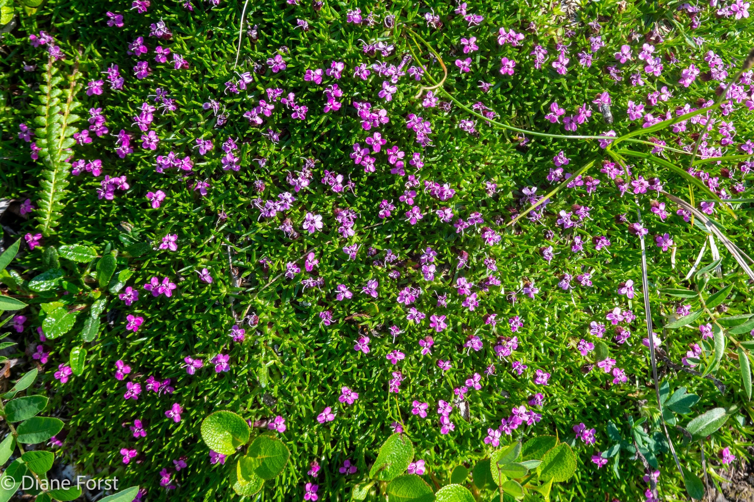
Moss Campion, Summit Lake, Stone Mountain Provincial Park, Northern Rockies, British Columbia, Canada
Today’s view of our campsite.

Summit Lake Campground, Stone Mountain Provincial Park, Northern Rockies, British Columbia, Canada
Another view of our campsite from a different angle.

Summit Lake Campground, Stone Mountain Provincial Park, Northern Rockies, British Columbia, Canada
Kenny and Diane on the way back down.

Summit Lake, Stone Mountain Provincial Park, Northern Rockies, British Columbia, Canada
And just as we got back to the trailer.

Summit Lake, Stone Mountain Provincial Park, Northern Rockies, British Columbia, Canada
The view from our campsite looking towards Summit Lake

Summit Lake Campground, Stone Mountain Provincial Park, Northern Rockies, British Columbia, Canada
Dinner tonight was Beef Stroganoff and peas.

Summit Lake Campground, Stone Mountain Provincial Park, Northern Rockies, British Columbia, Canada
Day 12 - Thursday July 4th
Today was one of our short drives, a total of 70 miles/113 km from Summit Lake Campground at Stone Mountain Provincial Park, BC, to Northern Rockies Lodge/RV Park at Muncho Lake, BC.
Sunrise today was at 4:20 AM at Summit Lake Campground, Stone Mountain Provincial Park, BC.
Sunset today was at 10:34 PM at Northern Rockies Lodge/RV Park, Muncho Lake, BC.
It was a beautiful day as we started out.

Summit Lake, Stone Mountain Provincial Park, Northern Rockies, British Columbia, Canada
Not long after leaving the campground we saw numerous Stone Sheep along the highway.
The poor, bow legged, sheep on the left looks a little old and rickety.

Stone Sheep, near Summit Lake, Northern Rockies, British Columbia, Canada
Some nice examples of rocky mountains as we drive through the Canadian Rocky Mountains.
Previously I have said that it often feels like we are alone out on the road, even though we know there are other people on the road with us. When we do see other traffic, it is pretty clear that a major portion of the traffic is RVs.

Alaska Highway (Hwy 97), near Toad River, British Columbia, Canada
More rocky mountains in the Canadian Rocky Mountains.

Alaska Highway (Hwy 97), near Toad River, British Columbia, Canada
Since our drive was so short we went as slow as we reasonably could, so when we came to a nice large pullout next to the Toad River along the Alaska Highway we stopped to look at the scenery.
Diane caught a cool photo below of Kenny and I taking photos pointing opposite directions.
Below is a gallery of photos, click on one of the photos and you can see enlarged versions that you can click through. Once you have enlarged a photo, if you hover over the image you will see the image title and description, to remove the title and description just move the mouse pointer off the photo.


We arrive at Muncho Lake.

Alaska Highway (Hwy 97), Muncho Lake, British Columbia, Canada
There was another interesting pullout along the Alaska Highway next to Muncho Lake that we pulled out in. This is where we learned the specific type of sheep we have been seeing.

Pullout, Alaska Highway (Hwy 97), Muncho Lake, British Columbia, Canada
This pullout had a large plain of rocks leading away from the lake into the mountains. I assume, but don’t know, that this was originally glacially carved and then flash floods have turned it into a large alluvial plain.
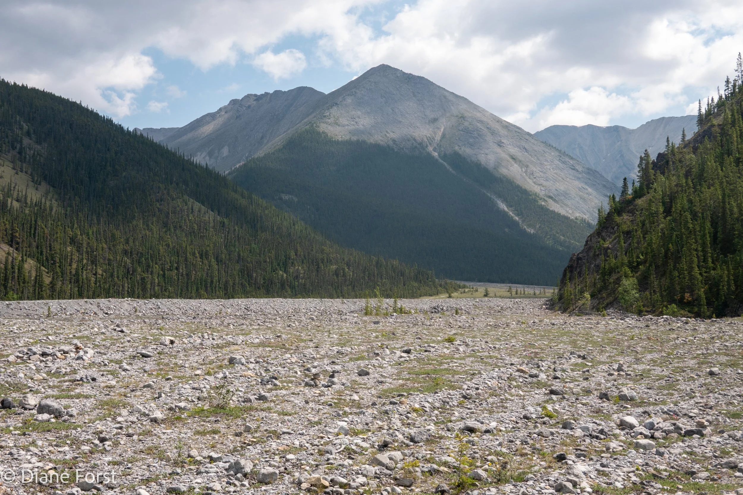
Pullout, Alaska Highway (Hwy 97), Muncho Lake, British Columbia, Canada
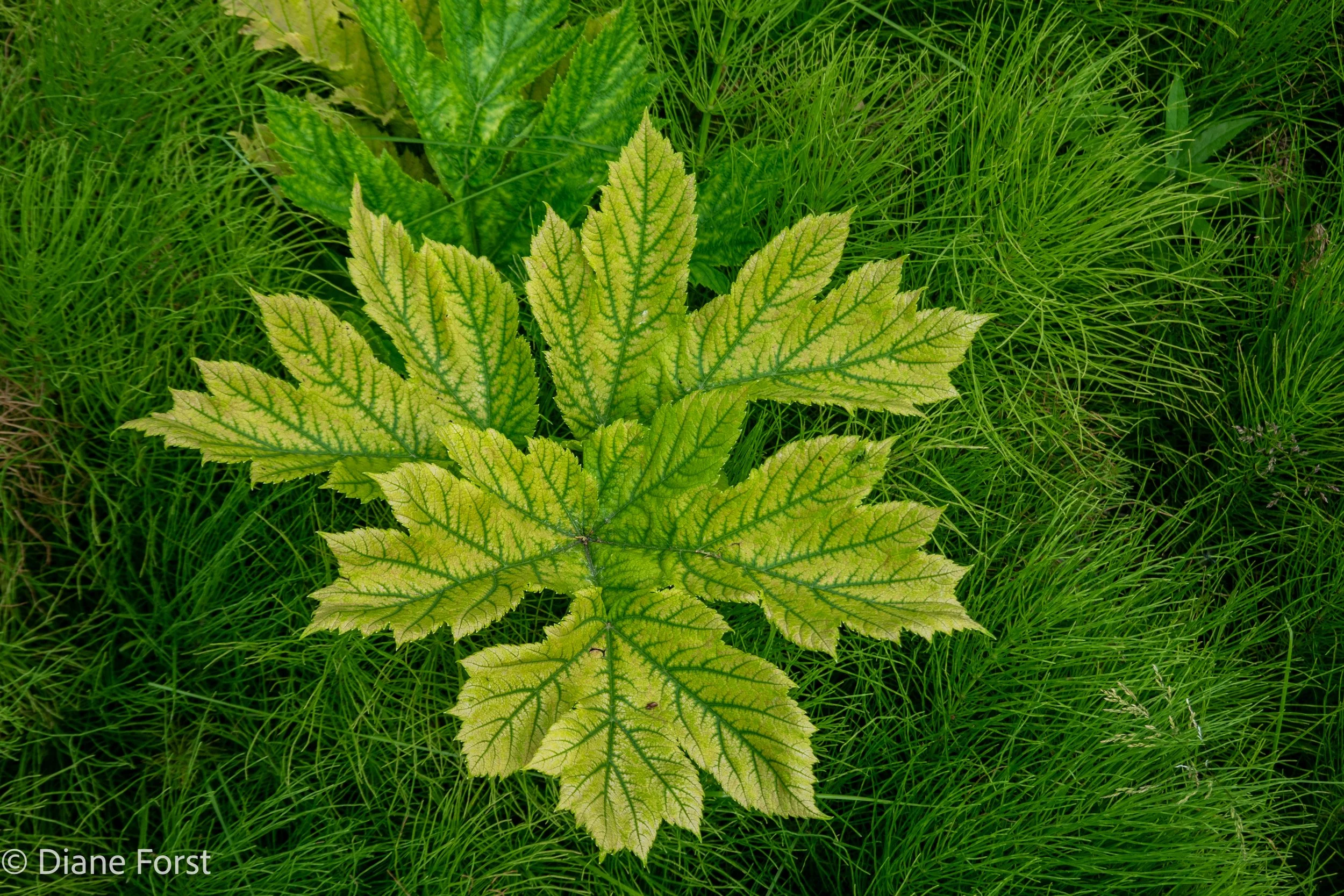
Diane took some cool photos of plants while walking out on this plain.


Once we arrived at our campground, Northern Rockies Lodge/RV Park, we were directed to a premium RV spot on the lake shore.

Northern Rockies Lodge/RV Park, Muncho Lake, British Columbia, Canada
The only catch was that to get to it, we have back the trailer all the way down a portion of the lake front to get to our site. Where we had to start backing down is shown in the photo below where the white RV is in the distance.

Northern Rockies Lodge/RV Park, Muncho Lake, British Columbia, Canada
We had RV site “RV 1”, right next to the floatplane docks. It was a great site.

Northern Rockies Lodge/RV Park, Muncho Lake, British Columbia, Canada
Here is Deneen hanging out and enjoying the scenery.

Northern Rockies Lodge/RV Park, Muncho Lake, British Columbia, Canada
Not long after we arrived, a floatplane flew in that we were able to watch land. The lodge has several floatplanes that they fly customers out to remote, non-accessible, lakes to fish and stay at the lodge’s outpost cabins.


Since this is the 4th of July and the place we are staying has a lodge dining room we ate out this evening.
Kenny of course had steak, and Diane, Deneen and I had their Northern Rockies Pork Schnitzel with creamy mushroom sauce. It was all very tasty.
The dining room also had some interesting art.


Below is a gallery of our desserts for tonight!


Contentment while walking back to the trailer after a great dinner with Diane, Kenny and Deneen, and not to forget the two bottles of wine.

Northern Rockies Lodge/RV Park, Muncho Lake, British Columbia, Canada
Day 13 - Friday July 5th
Today we drove north west on the Alaska Highway 36 miles/58 km, from Northern Rockies Lodge/RV Park, BC, to Liard River Hot Springs, BC.
Sunrise was 4:22 AM at Northern Rockies Lodge/RV Park, BC.
Sunset was 10:38 at Liard River Hot Springs, BC.
Below is the view this morning from the front of our campsite.

Northern Rockies Lodge/RV Park, Muncho Lake, British Columbia, Canada
It was fun to watch on the of the floatplanes get loaded with gear and passengers and take off.


Then is was time to head down the lonely road. Today was also not a very long drive so we were able to take it easy.
Before leaving we used the RV dump station at the Northern Rockies Lodge/RV Park. While we were using it, we noticed a caribou running down the road, being followed by a car. We were not in a position to take a photo, and so far we have not see any other caribou.

Alaska Highway (Hwy 97), north of Muncho Lake, British Columbia, Canada
A ways down the road, we did see a large number of Bison hanging out near to the Alaska Highway.


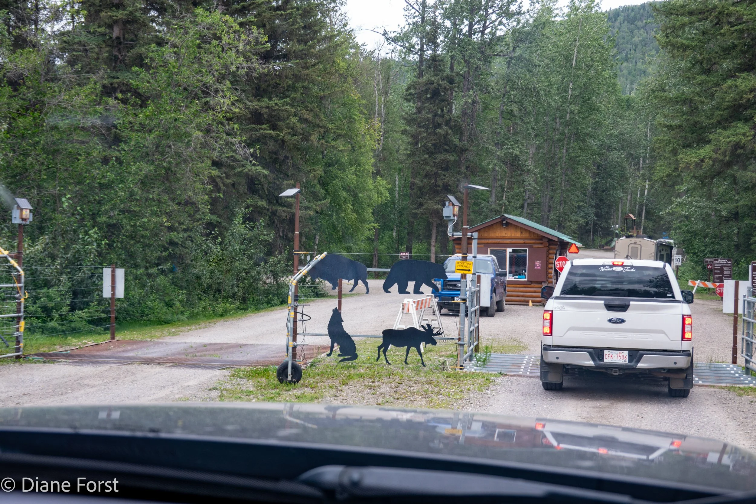
Once we reached Liard River Hot Springs, it was interesting to see the measures they have taken to keep the wildlife out of the campground. When I was last here, back in 2007 with Tony, there was no electric fence and I remember the rangers chasing a bear out of the campground with flash bangs.

We had a very large and very private campsite. Unfortunately this meant that Starlink did not work that well. It was only good from some news, texts and emails, it did not work for any interactive use of the internet. But compared to back in 2007 the communication ability was outstanding.

Campsite, Liard River Hot Springs Campground, along Alaska Highway, British Columbia, Canada
While the campground is surrounded by an electric fence, the 700 meter boardwalk leading to the hot springs is not. It caused me to look over my shoulder a few times.
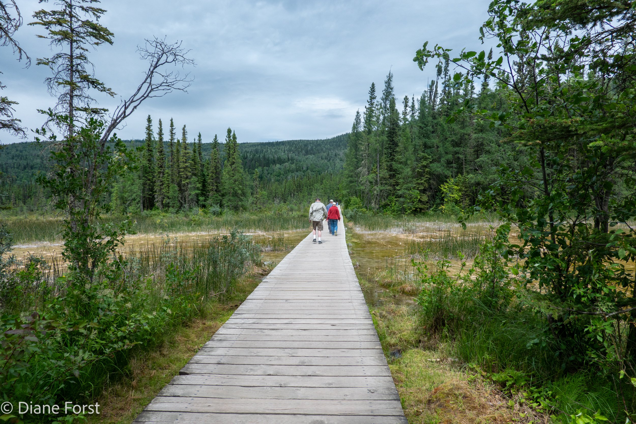
Boardwalk to Liard River Hot Springs from Campground, along Alaska Highway, British Columbia, Canada
The walk out to the hots springs was pretty.

Boardwalk to Liard River Hot Springs from Campground, along Alaska Highway, British Columbia, Canada
The hot springs was even prettier.
Kenny has never been to a hot springs before and was excited to try it out. We spent a fair amount of time soaking and trying to get as close to the hot end of the pool as possible, which is the foreground of the photo below. The challenge was get close enough to stack a rock on the edge of the pool. It was very difficult to do, the water is very hot, and the only way to do it is to constantly swirl colder water from below up to cool the water off. All of us, except Kenny (mostly because I would not let him do it) made it to the end, and maybe Deneen and/or Diane actually managed to stack a rock. I only managed to touch the rock pile before escaping back to cooler water.

Liard River Hot Springs, along Alaska Highway, British Columbia, Canada
Diane captured some great flora photos while we were out there.

For dinner, we had stir-fried chicken and carrots mixed with rice noodles.

Dinner, Liard River Hot Springs Campground, along Alaska Highway, British Columbia, Canada
Day 14 - Saturday July 6th
We spent two nights at Liard River Campground, so today is a full day here.
Today at Liard River Campground sunrise was at 4:21 AM and Sunset was at 10:37 PM.
While we did not move the trailer, we did drive 88 miles/142 km to explore and do some hikes.
We spent part of our day this morning working on our computers. Kenny has found a way to relax while he waits.

Liard River Hot Springs Campground, along Alaska Highway, British Columbia, Canada
Once we finished our computer work we headed out for the first of several short hikes.
The first place was Smith River Falls at Smith River/Fort Hackett Protected Area. It involved a 5 km or so drive out a one lane, very bumpy, dirt road. Once we got there we could see the falls, as shown below, from the small parking area.

Smith River Falls, Smith River/Fort Hackett Protected Area, BC, Canada
From the parking area there was a short, but steep, trail down to the bottom of the falls. Kenny did not enjoy going down some steep, and very uneven, stairs nor some steep trail sections. But he was happy to be at the bottom and to see the falls from a different perspective. Going back uphill was not a problem. Meanwhile the rest of us kept an eye out for any bears around the next bend in the trail.


We saw three black bears today from the truck and we were able to take photos of them. My favorite is Kenny and a large black bear having a staring contest.

Kenny & Bear, Alaska Highway (Hwy 97), Coal River, Northern Rockies, British Columbia, Canada
Below is a closer photo of the bear from above, and a couple other bears we were able to photograph.


British Columbia has the most manicured highways I have ever seen.

Alaska Highway (Hwy 97), Northern Rockies, British Columbia, Canada
We also visited a place along the Liard River known as Whirlpool Canyon.


Our final hike of the day was to Teeter Creek Falls. It was a little over one kilometer hike in through some dense forest and bushes. It seemed like an ideal area for bears to be hanging out in, so we were looking very carefully around every bend in the trail. Below is a short road into the trailhead, once on the trail, the brush left just enough room to get through.

Teeter Creek Falls Trailhead, Alaska Highway (Hwy 97), Northern Rockies, British Columbia, Canada
Despite staying bear aware, it was a pleasant hike to a small but pretty falls. One interesting thing was that once we got there, there was this strange bridge structure crossing the creek that did not go anywhere. After looking at it closely it looked to be a structure supporting water flow measurement equipment. I think this was a designated water flow measurement point.


Diane found some pretty butterflies and flowers along the trail.


By this point in the trip, we have basically run out of all our booze except for some vodka. So we invented a new drink which we named an Alaskan Sparkle.
Alaskan Sparkle
1-1/2 oz Vodka
3/4 oz Pomegranate Syrup
1 oz Dry Vermouth
3/4 oz Fresh Lime Juice
3 Dashes of Regans’ Orange Bitters
Garnish with dried orange slice

Alaskan Sparkle, Liard River Hot Springs Campground, along Alaska Highway, British Columbia, Canada
Tonight we had mushroom risotto for dinner.

Mushroom Risotto, Liard River Hot Springs Campground, along Alaska Highway, British Columbia, Canada